

Geolocation
PIXALARM embedds its own cartography server, based on «Geoserver». Pre-configured with some defaults maps, your own mapd data can be uploaded in order to bring localization to detections and alarms.
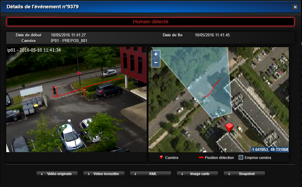
Hence, the positions, view areas of cameras and detections can be displayed in the available maps.
The mapping of field of view ease the placement of cameras, allowing users to detect blind spot and to optimize their positions.
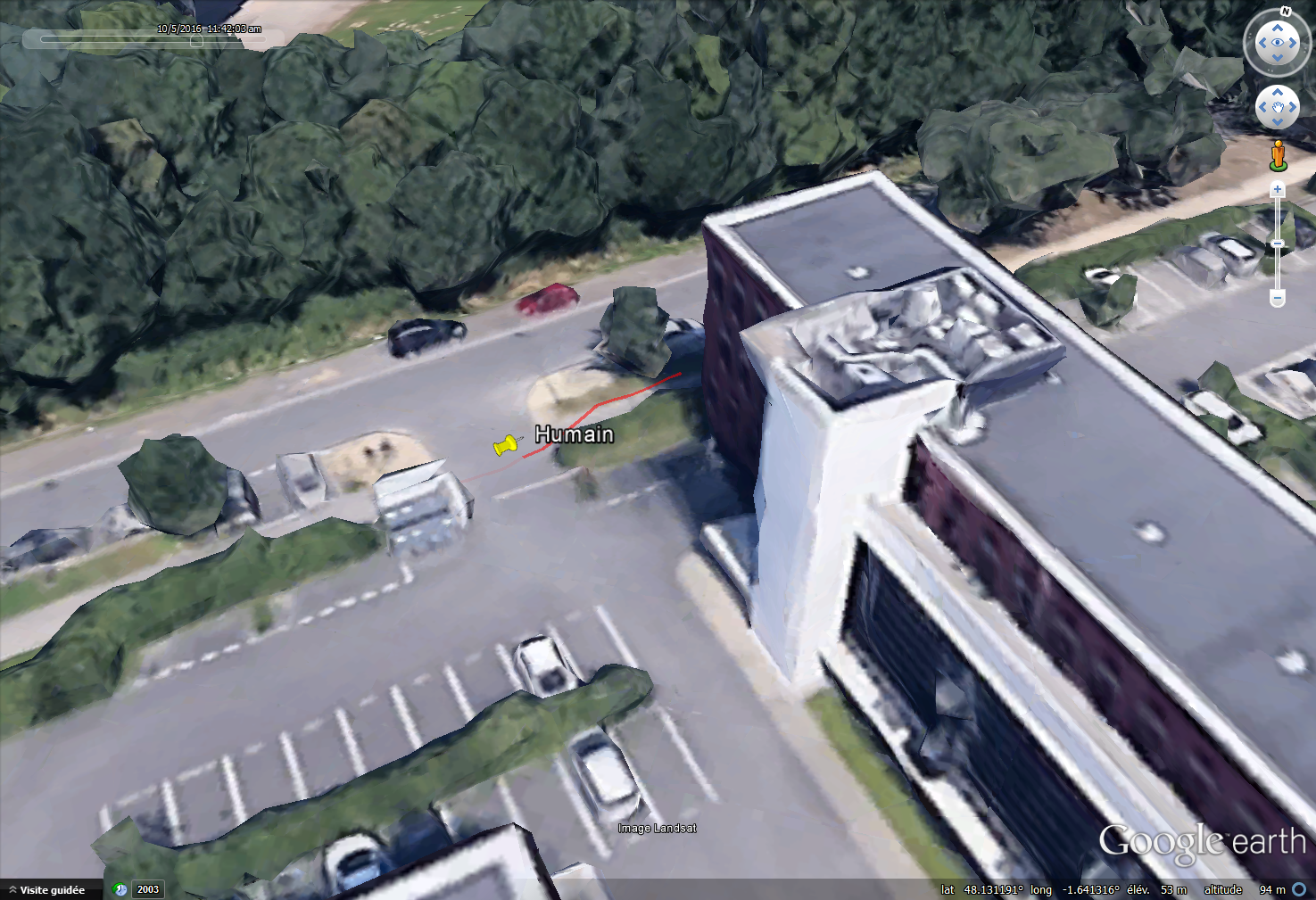
Geolocation of alarms can be exported in KML format, in order to be used in third-party applications like Google Earth.